


Voting District 0014, Gregg County, Texas
About
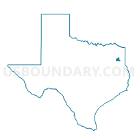
Outline

Summary
| Unique Area Identifier | 673483 |
| Name | Voting District 0014 |
| County | Gregg County |
| State | Texas |
| Area (square miles) | 53.02 |
| Land Area (square miles) | 52.94 |
| Water Area (square miles) | 0.09 |
| % of Land Area | 99.83 |
| % of Water Area | 0.17 |
| Latitude of the Internal Point | 32.43149900 |
| Longtitude of the Internal Point | -94.91426340 |
Maps


Graphs
Select a template below for downloading or customizing gragh for Voting District 0014, Gregg County, Texas


Neighbors
Neighoring Voting District (by Name) Neighboring Voting District on the Map
- Voting District 0008, Smith County, TX
- Voting District 0010, Smith County, TX
- Voting District 0011, Gregg County, TX
- Voting District 0012, Gregg County, TX
- Voting District 0013, Gregg County, TX
- Voting District 0015, Gregg County, TX
- Voting District 0017, Gregg County, TX
- Voting District 0024, Smith County, TX
- Voting District 0046, Smith County, TX
- Voting District 0112, Rusk County, TX
Top 10 Neighboring County Subdivision (by Population) Neighboring County Subdivision on the Map
- Longview CCD, Gregg County, TX (83,993)
- Tyler East CCD, Smith County, TX (19,374)
- Kilgore CCD, Gregg County, TX (10,603)
- Kilgore CCD, Rusk County, TX (9,033)
- Liberty City CCD, Gregg County, TX (8,417)
- Gladewater CCD, Gregg County, TX (7,841)
- Winona CCD, Smith County, TX (5,646)
Top 10 Neighboring Place (by Population) Neighboring Place on the Map
Top 10 Neighboring Unified School District (by Population) Neighboring Unified School District on the Map
- Pine Tree Independent School District, TX (24,937)
- Chapel Hill Independent School District, TX (21,258)
- Kilgore Independent School District, TX (21,202)
- Gladewater Independent School District, TX (11,893)
- Sabine Independent School District, TX (6,615)
- White Oak Independent School District, TX (6,596)
- Overton Independent School District, TX (3,362)
- Leveretts Chapel Independent School District, TX (921)
Top 10 Neighboring State Legislative District Lower Chamber (by Population) Neighboring State Legislative District Lower Chamber on the Map
- State House District 6, TX (170,168)
- State House District 7, TX (161,276)
- State House District 11, TX (151,703)
Top 10 Neighboring State Legislative District Upper Chamber (by Population) Neighboring State Legislative District Upper Chamber on the Map
Top 10 Neighboring 111th Congressional District (by Population) Neighboring 111th Congressional District on the Map
Top 10 Neighboring Census Tract (by Population) Neighboring Census Tract on the Map
- Census Tract 104, Gregg County, TX (8,417)
- Census Tract 102, Gregg County, TX (7,841)
- Census Tract 18.01, Smith County, TX (6,336)
- Census Tract 9503, Rusk County, TX (5,931)
- Census Tract 106, Gregg County, TX (5,674)
- Census Tract 15, Smith County, TX (5,646)
- Census Tract 103.02, Gregg County, TX (5,525)
- Census Tract 107, Gregg County, TX (4,929)
- Census Tract 9, Gregg County, TX (3,143)